This scenic road trip itinerary takes you to Valley of Fire State Park, Zion National Park, Vermilion Cliffs National Monument, Page, Horseshoe Bend, Lake Powell, Glen Canyon, Grand Canyon National Park and Sedona, before returning to Las Vegas. Discover incredible national parks, scenic drives, unique places to explore, and practical tips on this ultimate USA Southwest road trip.
Ultimate Southwest Road Trip Itinerary: The Best 10-14 Day Las Vegas Loop
This is one of our favorite road trips through the Southwest, combining some incredible national parks with red rock canyons, desert scenery, scenic drives and plenty of interesting stops along the way.
Starting and ending in Las Vegas, this 875-mile loop takes you to Zion National Park, through Vermilion Cliffs to Page and Lake Powell, then on to the Grand Canyon and Sedona before heading back to Vegas. Along the way you can hike the Fire Wave at Valley of Fire, explore Antelope Canyon, boat into the narrow canyons of Lake Powell, stand on the rim of the Grand Canyon and spend a few days exploring the red rocks around Sedona.
What to Expect on This Southwest Road Trip
Three states, three national parks, one national monument, the two largest dams in the U.S., one scenic town and one over-the-top city. This road trip has a little bit of everything. We’ve broken the road trip into five manageable legs, but don’t feel like you have to rush it. There is a lot to see along this route, and some of our favorite stops are actually between the main destinations.
Las Vegas is also an easy place to start the trip. Harry Reid International Airport (LAS) has plenty of domestic and international flights, and you can rent a car, RV or even a motorcycle when you arrive. Explore Vegas before you leave, save it for the end—or pick up your vehicle and hit the road!
Las Vegas, Nevada to Zion National Park, Utah
Zion National Park, Utah to Page, Arizona
Page, Arizona to Grand Canyon National Park, Arizona
Grand Canyon National Park, Arizona to Sedona, Arizona
Sedona, Arizona to Las Vegas, Nevada
Las Vegas, Nevada
Our road trip itinerary starts and ends in Las Vegas, Nevada and is broken into five legs. The Harry Reid International Airport (LAS) in Las Vegas provides easy access to both domestic and international visitors. You can rent a car, RV, or even a motorcycle in Vegas for this fantastic tour of the southwest. Upon arriving in Las Vegas, you can choose to stay and explore all the city has to offer, or hit the road and explore the city when you return.
See our article about Las Vegas, Nevada for more details about the city.

Las Vegas, Nevada to Zion National Park, Utah
| Travel Time | 2.5 hours |
|---|---|
| Distance | 165 miles (266 km) |
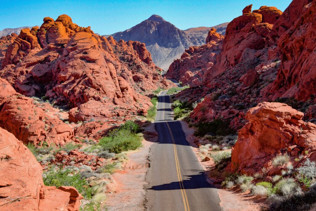
The first leg of this trip starts by taking Interstate 15 north out of Las Vegas. You will pass the Las Vegas Motor Speedway on your right and you may see a military jet or two flying around from the nearby Nellis Air Force Base. Continuing north you will get to the exit that takes you to the Valley of Fire State Park, which you can also explore from Las Vegas, just spend a few hours here on your way to Zion National Park or, if you are camping, this park has 72 campsites spread out over 2 campgrounds.
Valley of Fire State Park
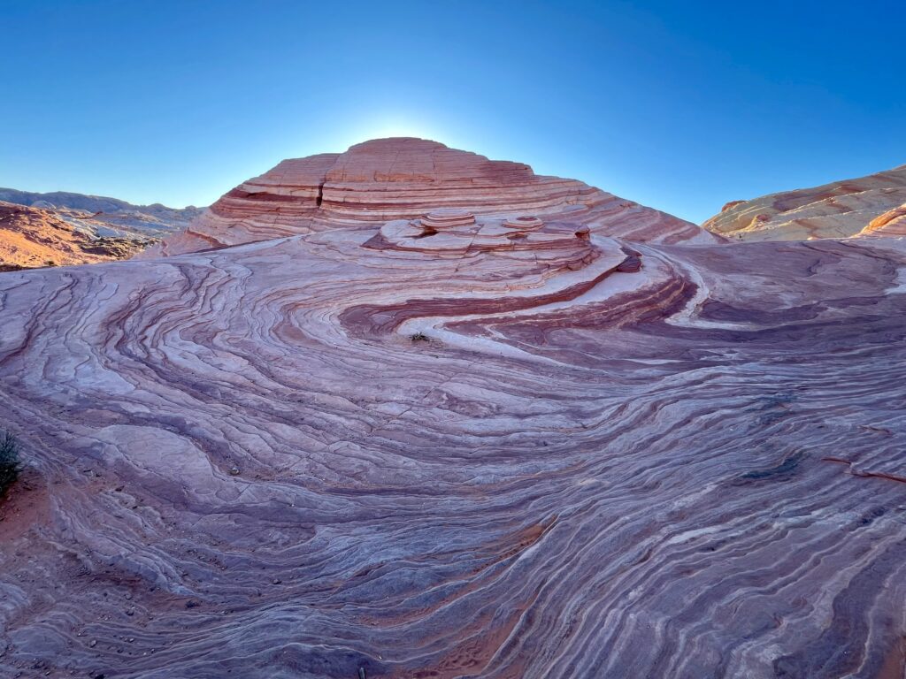
Valley of Fire State Park has some excellent hiking and photography. Hiking Fire Wave is not to be missed -it is just a short hike from the closest parking lot, about a 1.5 mile (2.4 km) round trip. Do the out and back hike if you are pressed for time. If you have longer you can make this into a longer loop hike. If you can see the Fire Wave at sunrise or sunset, it is even more spectacular. We went closer to sunset, making it the last part of the park we explored, it was absolutely stunning.

Continuing north on Interstate 15, you’ll cross briefly into Arizona before entering Utah, where the scenery begins to change dramatically from open desert to towering red rock cliffs.
Zion
From here, head toward Zion National Park, one of the highlights of this road trip itinerary. Plan on at least a full day in Zion, and longer if you want to tackle some of its famous hikes. Even if you’re not a big hiker, the drive into Zion and the massive sandstone cliffs surrounding Zion Canyon make the park worth the stop.
Our Zion National Park guide has everything you need to plan your time in the park, including the best hikes, viewpoints and practical tips for getting around.

Zion National Park, Utah to Page, Arizona
| Travel Time | 3 hours |
|---|---|
| Distance | 160 miles (256 km) |
This isn’t the fastest or most direct route—but that’s part of the fun! The drive takes you through the spectacular Vermilion Cliffs National Monument, with towering red cliffs and wide-open desert scenery along the way. Keep an eye on the sky, too. If you’re lucky, you might spot one of the area’s enormous California condors soaring overhead.

Depending on where you stayed near Zion National Park , you can either take 89 east or 59 south east to 389 east. Both routes meet in Fredonia where you take 89A through Vermilion Cliffs National Monument. Upon leaving Vermilion Cliffs National Monument you will take 89 north to Page, Arizona.
Horseshoe Bend
It is well worth stopping at Horseshoe Bend, where the Colorado River makes a dramatic 180-degree turn around a massive sandstone cliff. A short walk takes you right to the rim, where you can look nearly 1,000 feet down to the river winding through the canyon below. It’s one of those views that is even more impressive in person than it is in photos.

Lake Powell
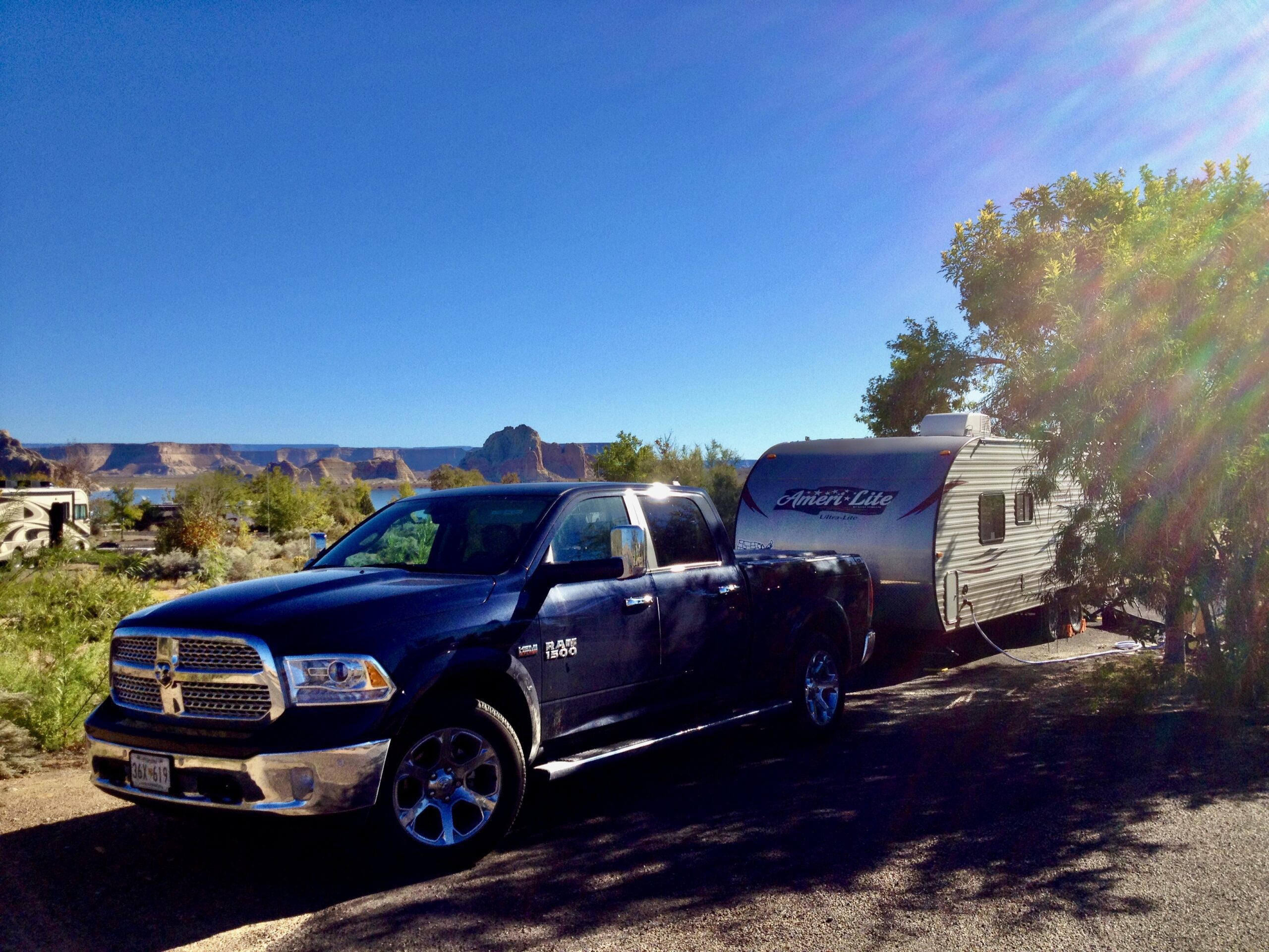
Lake Powell, is about a 15-20 minute drive from Page. The lake has two marinas where you can rent either small motor boats to explore Lake Powell for a day or house boats that you can book for multiple nights. We were there on an RV trip and, camped really close to the shore of Lake Powell at the Wahweap RV Campground. We rented a motor boat at the marina near the campground and spent the day out on the lake with the family, swimming, tubing, and exploring. If you do this, definitely don’t miss Labyrinth Canyon!
Labyrinth Canyon
Exploring Labyrinth Canyon was one of our favorite parts of our visit to Lake Powell. it’s a flooded side canyon in Lake Powell’s Padre Bay area and is also a designated wakeless canyon. You can turn right off the main channel and follow the water deep into the canyon as the sandstone walls close in around you. Even where the canyon narrows to just a few feet, the water can still be more than 200 feet deep, depending on lake levels. Eventually, the water ends and the canyon turns into a dry slot canyon—so make sure you leave yourself room to turn the boat around!

Page
The town of Page sits just south of Lake Powell and Glen Canyon National Recreation Area. We found Page more useful as a base for exploring the area than as a destination itself—but it’s a great place to stock up on supplies, grab a meal and take care of anything you need before heading back out. We even managed to get our daughter’s glasses repaired here!
As you follow Route 89 through the area, you’ll cross the bridge right next to Glen Canyon Dam with impressive views below. If you have time, stop at the Carl Hayden Visitor Center for a closer look at the dam and to learn a little more about how Lake Powell was created.
Antelope Canyon
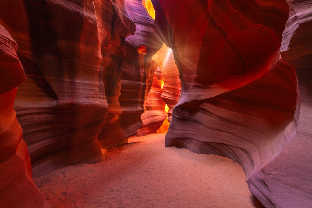
Antelope Canyon tours are also a must when visiting Page. Antelope Canyon is located on Navajo Nation land, and you can’t explore it on your own. Visitors must book with an authorized Navajo Nation tour operator, with different companies serving Upper, Lower and other sections of the canyon.
Your Navajo guide shares stories about the canyon, its cultural significance, how it was formed and the impact of flash floods that continue to shape it today. They’ll also point out some of the canyon’s most interesting formations—and know exactly where to stand for the best photos!
Page, Arizona to Grand Canyon National Park, Arizona
| Travel Time | 2.5 hours |
|---|---|
| Distance | 135 miles (217 km) |
Leaving Page you can take either Route 64 south or Route 89 south. If you did not stop at Horseshoe Bend on the way to Page you can stop there now by taking Route 89 south instead of Route 64. Taking Route 64 south is slightly more direct, but will eventually meet up with Route 89 south. When you reach the town of Cameron Route 64 turns west. Follow Route 64 west all the way to Grand Canyon Village.
Grand Canyon National Park
The Grand Canyon is another major stop on this road trip, and no matter how many photos you’ve seen, they really don’t prepare you for the scale of it in person. Give yourself at least a full day to explore the South Rim, stopping at the overlooks and walking a section of the Rim Trail. If you have more time, stay overnight and catch a sunset or sunrise over the canyon.
Want to Explore Below the Grand Canyon’s South Rim?
If you have more than a few hours at the Grand Canyon, consider hiking below the rim for a completely different perspective. There are options for shorter hikes as well as more challenging trails, and mule rides offer another way to experience the canyon. Before your visit, check out our guide to hikes and mule rides from the Grand Canyon’s South Rim to explore your options and decide what fits your schedule and ability.
See our Grand Canyon National Park guide for everything you need to plan your visit.

Grand Canyon National Park, Arizona to Sedona, Arizona
| Travel Time | 2.5 hours |
|---|---|
| Distance | 115 miles (185 km) |
Leave Grand Canyon Village on Route 64 south. When you reach Grand Canyon Junction, you can either continue on Route 64 south or take Route 180 south, which is slightly longer but more scenic. If you take 64 south you will have to get on Interstate 40 east at Williams. Either way will take you to Flagstaff where you will get on Interstate 17 south briefly before getting on Route 89A south. Route 89A south takes you down Oak Creek Canyon and into Sedona.
Sedona
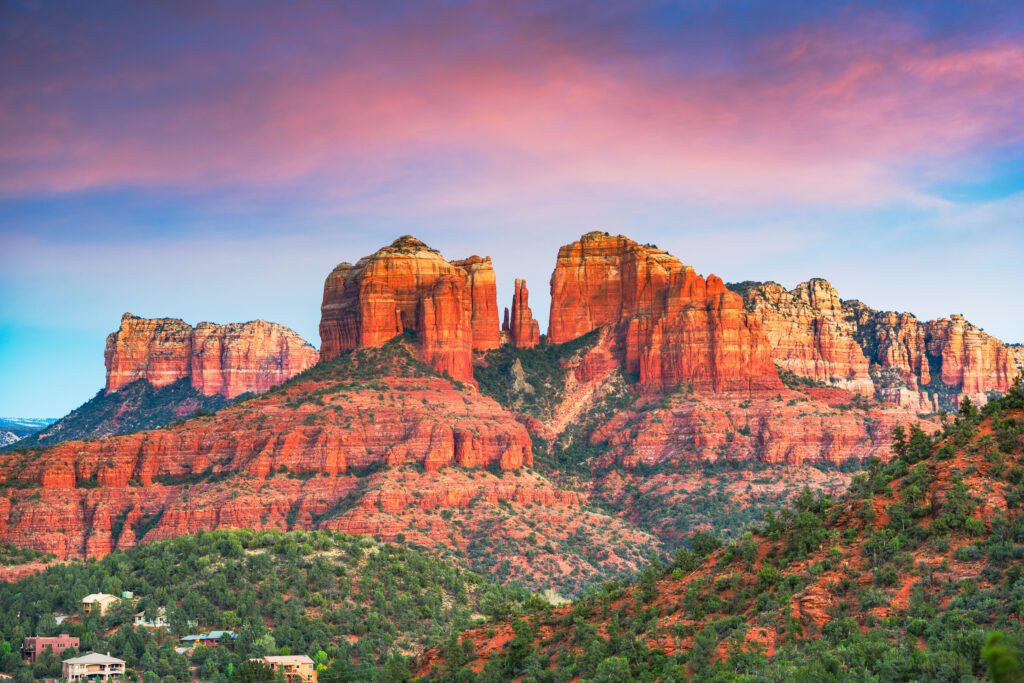
Sedona is one of our favorite places in Arizona, and somewhere we’ve returned to many times. Surrounded by incredible red rock formations, it’s the kind of place where the scenery starts before you even get out of the car, but you’ll definitely want to get out and explore.
There are fantastic hikes for just about every ability, scenic drives, Jeep and 4WD adventures, a thriving art scene, great restaurants…and don’t forget the vortex!
Best Hikes in Sedona: Our Favorite Trails
If hiking is on your list, Sedona has some of the best trails in Arizona, with incredible red rock scenery around every corner. We’ve hiked here many times and have a few trails we keep coming back to. Check out our three favorite hikes in Sedona to help you decide which trails to add to your itinerary.
Looking for an Off-Road Adventure in Sedona?
One of our favorite ways to explore Sedona’s red rock landscape is getting off the paved roads. We took an ATV along the famous Broken Arrow Trail, and it’s an adventure worth considering if you enjoy exploring beyond the usual viewpoints. Read about our Broken Arrow off-road ATV adventure for a firsthand look at the experience and what to expect.
We recommend spending at least a couple of days here if your road trip allows it. Check out our Sedona Travel Guide for our favorite hikes, places to explore and tips we’ve picked up over many visits.
Sedona, Arizona to Las Vegas, Nevada
| Travel Time | 5.5 hours |
|---|---|
| Distance | 300 miles (483 km) |
At 5 to 6 hours, depending on which route you take, this is the longest driving day of the trip. Leaving Sedona on Route 89A west you will pass through Cottonwood, climb up to Jerome and drive back down to Prescott Valley.
Jerome
Jerome, Arizona: Historic Mining Town and Ghostly Attractions
Jerome is a great place for a leg stretch and a bite to eat. This old copper mining town now boasts a thriving artist community, historic sites, a number of shops and restaurants and the fascinating Gold King Mine & Ghost Town, which is a wonderful place to explore. Jerome is also known for its haunted history. Lean into the ghostly theme with a meal at Haunted Hamburger while enjoying excellent views of the valley below from the deck.
Choosing Your Route: Scenic Highway 89A or Historic Route 66
Shortly after leaving Prescott Valley you can choose between heading north on Route 89 to Interstate 40, which is the quickest way, or continue on Route 89A west for a more scenic, but winding way through the mountains.

Taking the first and quickest option of Route 89 north to Interstate 40 west allows you to take a detour on part of the original Route 66 through Peach Springs. You can even spend the night here if you want to break up the drive. Peach Springs is also where you can obtain a permit and drive to the bottom of the Grand Canyon if you have a 4-wheel drive vehicle. This detour will meet up with Interstate 40 at Walnut Creek.
Travel Tip: If you are doing this road trip in an RV or towing a travel trailer you may want to take the route described above as the following route will be lots of twists and turns over mountainous roads.
Taking the second option of Route 89A west through the mountains you will eventually get to a T intersection where you will take 93 north to Interstate 40 west. All routes will end up going through Walnut Creek. This is a good place to spend the night if you want to break up this long driving day.
Hoover Dam: The Final Stop Before Las Vegas
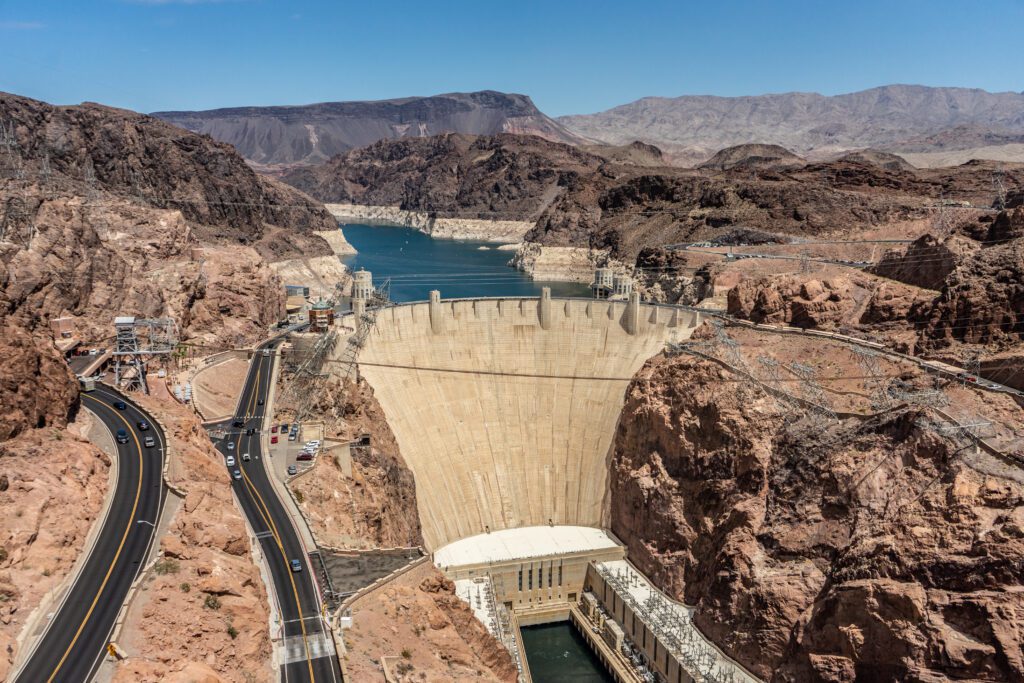
From Walnut Creek take Route 93 north west to the Hoover Dam. There are places to stop and take pictures of the dam on either side of the Colorado River and you can even take a tour that takes you inside to see how the dam generates electricity. From the Hoover Dam it is a fairly short drive on Interstate 11 back to Las Vegas and the end of this road trip.
Summary
By the time you roll back into Las Vegas, you’ll have covered nearly 875 miles through some of the most spectacular landscapes in the Southwest. You’ll hike among the red rocks of Zion, drive beneath the Vermilion Cliffs, look down on Horseshoe Bend, explore the waters and hidden canyons of Lake Powell, walk through Antelope Canyon, stand on the rim of the Grand Canyon and spend time among the red rocks of Sedona.
Along the way are scenic drives, old mining towns, stretches of historic Route 66, two massive dams and plenty of unexpected stops that make a road trip like this so much fun.
It’s an incredible amount to see in one loop—and one of the best road trips we’ve found for experiencing just how varied and spectacular the American Southwest can be.